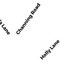
0 HOLLY LN
Owner Information
BIGELOW WILLARD III & LAUREN W T/E
404 ARLINGTON ST
ACTON, MA 01720


Property Details
0 HOLLY LN is classified as a Undevelopable Residential Land (Vacant land).
0 HOLLY LN is valued at $31,700. The land is valued at $31,700 and the structures are valued at $0.
This property is in Zone R30. Confirm with local Zoning Board authorities to ensure there are no overlays or other easements on this property.
The most recent deed for 0 HOLLY LN is recorded at the local registrar in Book 106426, Page 000C. 0 HOLLY LN was last sold on Wednesday, November 10, 2004 for $540,000.
Assessment data from fiscal year 2022.
Flood Data
This property is partially within the AE Zone (within floodplain). Approximately 0.7 acres (84.03%) of the property is within this zone.
The base flood elevation for this flood zone is 16 feet.
This information is sourced from the FEMA National Flood Hazard Layer. See our full disclamer.
Broadband Internet Providers
| Provider | Type | Bandwidth (mbps) | |
|---|---|---|---|
| Comcast | Cable | 1000 | 35 |
| HughesNet | Satellite | 25 | 3 |
| VSAT Systems, LLC. | Satellite | 2 | 1 |
| GCI Communication Corp. | Satellite | 0 | 0 |
| Viasat Inc | Satellite | 35 | 3 |
| Verizon New England Inc. | DSL | 5 | 0 |
| Verizon New England Inc. | Fiber | 940 | 880 |
Broadband service provider data from December 2020.
Adjacent Properties
- 0 BRIERPATCH LN W OF
Undevelopable Residential Land owned by BIGELOW WILLARD III & LAUREN W T/E - 6 HOLLY LN
Single Family Residential owned by FRANCESCHINA LOUIS TRUSTEE OF THE LOUIS - 31 NEDS POINT RD
Single Family Residential owned by BIGELOW WILLARD III & LAUREN W - 29 NEDS POINT RD
Single Family Residential owned by MACINA THOMAS F & LESLIE M